|
|
 |
|
Long
Island Trails
DISCOVER
all of Long Island's nature and recreation
trails and the habitats surrounding them.
|
|
|
|
|
 |
|
|
|
|

|
|
Welcome
to LiTrails.com
|
Long Island has many trails including: nature trails, hiking trails,
biking trails, equestrian trails,
cross-country, skiing trails, and more. |
|
|
|
|
|
|
|
|
|
|
|
|
 |
 |
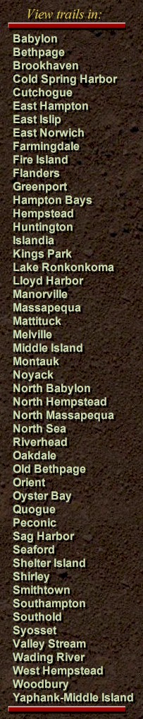
Montauk
HITHER WOODS WEST is over 3,000 acres of diverse oak woods, grass lands, walking dunes and sandy beaches. Hither Woods is a priceless natural resource, offering hikers and bikers year round access to unspoiled nature.
More
info & photos
 |
|
Trail Map |
map
it |
|
|
|
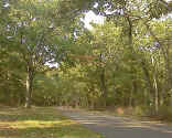
HITHER WOODS WEST
|
|
|
|
|
|
|
|
 |
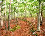
Smithtown
CALEB
SMITH STATE PARK PRESERVE nature trails for hiking,
cross-country skiing, and fly fishing. enjoy freshwater wetlands,
ponds, streams, fields and upland woods. Caleb preserve is a refuge
for wildlife. Open year round from approximately 8 AM to Sunset.
Closed Mondays: April - September. Closed Mondays and Tuesdays:
October - March. More
info & photos
|
| More info/photos |
map
it |
|
|
|
CALEB SMITH
STATE PARK
|
|
|
|
|
|
|
|
 |
East
Hampton
CEDAR POINT COUNTY PARK is a 607 acre
park, with nature trails and vehicle access to the outer
beach, views of Gardiner's Bay, Individual and group camping,
picnic areas, boat rentals, surf fishing, (with permit) and licensed
hunting for waterfowl ( in season). More
info & photos
|
|
map
it |
|
|
|
CEDAR POINT
COUNTY PARK
|
|
|
|
|
|
|
|
 |
East
Islip
HECKSCHER
STATE PARK has
Twenty miles of trails for hiking, biking and cross-country skiers. Saltwater fishing in the Great South Bay is available.
Picnic areas, a boat launch ramp, playing fields, playground and 69
camp sites. Vehicles under eleven feet high can come into the
campgrounds. More
info & photos
|
|
map
it |
|
|
|
HECKSCHER STATE PARK
|
|
|
|
|
|
|
|
 |
Montauk
CAMP HERO
has 5 trails and is a former Military base in Montauk, NY. This park has magnificent pristine maritime forest, natural freshwater wetlands, spectacular ocean vistas and large ocean bluffs It was given to the New York State Office of Parks, Recreation and Historical Society in the
1980's. More
info/photos
|
|
Trail Map |
map
it |
|
|
|
CAMP HERO STATE PARK
|
|
|
|
|
|
|
|
 |
|
|
|
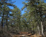
SEAL HAUL TRAIL
|
|
|
|
|
|
|
|
 |
 |
Hampton
Bays
SEARS BELLOWS
COUNTY PARK has an
extensive trail system and attracts hikers and horseback riders
(horseback riding Permit required.) Freshwater Pond fishing
permitted. Campsites: 70 tent & trailer. Features: 693 acres,
beach, showers, rowboats. Also features bird watching, bike hostel,
cross-country skiing weather permitting. More
info & photos
|
|
|
map
it |
|
|
|
SEARS BELLOWS
COUNTY PARK
|
|
|
|
|
|
|
|
 |
|
Montauk
OYSTER POND TRAIL
is a trail well worth
hiking. Also assessable by vehicle if you have a 4x4, You can get
here if you drive along Gin beach heading east. Nice views, diverse eco system
at the end you'll be taken to block island sound as well as Oyster pond.
More
info & photos
|
|
Trail Map |
map
it |
|
|
|
OYSTER POND TRAIL
|
|
|
|
|
|
|
|
 |
|
|
|
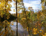
NISSEQUOGUE RIVER STATE PARK
|
|
|
|
|
|
|
|
|
|
|
|
|
|
|
|
|
|
|
|
|
|
|
|
|
|
|
|
|
|
|
|
<< Previous 1
2 3
4 5
6 7
8 9
10 11
12 Next
page Trail listings >>
|
|