|
|
 |
|
Long
Island Trails
DISCOVER
all of Long Island's nature and recreation
trails and the habitats surrounding them.
|
|
|
|
|
 |
|
|
|
|

|
|
Welcome
to LongislandTrails.com
|
Long Island has many trails including: nature trails, hiking trails,
biking trails, equestrian trails,
cross-country, skiing trails, and more. |
|
|
|
|
|
|
|
|
|
|
|
|
|
|
|
|
|
 |
 |
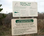
Quogue
QUOGUE WILDLIFE REFUGE has seven miles of
trails to explore diverse habitats including forests and ponds, as
well as the ecologically rare Dwarf Pines in the Pine Barrens.
n a nature preserve that is home to diverse wildlife including some
that are permanently injured and require human care to survive. 365
days a year, you can enjoy walking. More info/photos |
|
map
it |
|
|
|
QUOGUE WILDLIFE
REFUGE
|
|
|
|
|
|
|
|
 |
 |
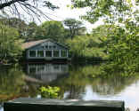
Melville
WEST HILLS COUNTY PARK has well-groomed
nature trails, including the historic Walt Whitman trail to Jayne's
Hill, Long Island's highest peak. Also a Fenced in dog run for dog
owners.
More info/photos
|
|
map
it |
|
|
|
WEST HILLS COUNTY PARK
|
|
|
|
|
|
|
|
 |
|
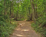
Middle
Island
ROCKY POINT
MOUNTAIN BIKE TRAIL is a one way trail of
challenging single track. Several uphill climbs and lots of turns.
The main loop is about 13 miles. There is an optional Westside loop
that will add 4 miles. Follow the yellow trail markers. There a few
black diamond loops in the northwest section of the park. More info/photos
|
|
|
|
|
|
ROCKY POINT MOUNTAIN BIKE TRAIL
|
|
|
|
|
|
|
|
 |
|
|
|
PECONIC DUNES
COUNTY PARK
|
|
|
|
|
|
|
|
 |
|
|
|
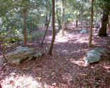
POINT WOODS TRAIL |
|
|
|
|
|
|
|
|
|
|
|
|
|
|
|
|
|
|
|
|
|
|
|
|
|
|
|
|
|
|
|
<< Previous
1 2
3 4
5 6
7 8
9 10
11 12
Next page trail listings
>>
|
|
|
|
|
|
|
|
|
|